Links: Regional Map of Study Area
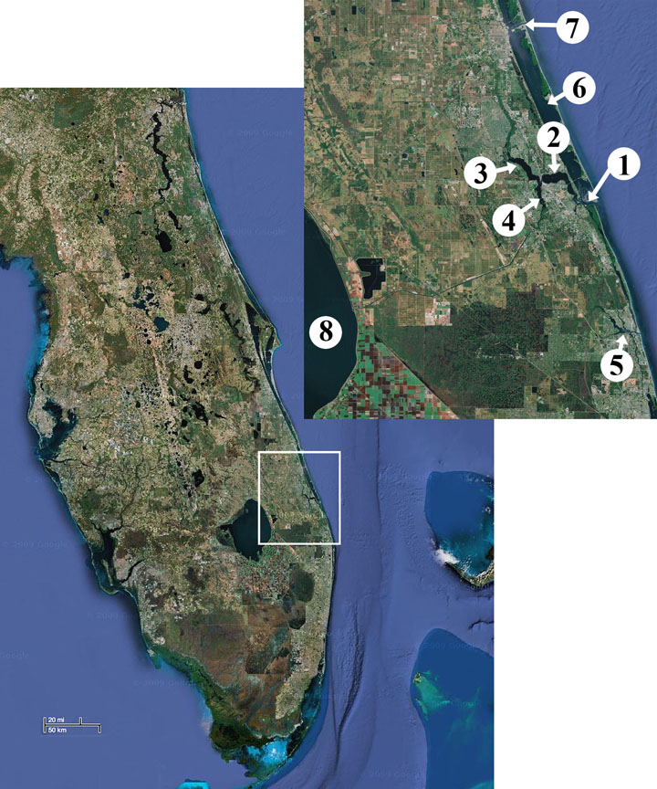
| Satellite image of the Florida peninsula. White box refers to upper, inset image showing the St. Lucie River study area. The inset image labels areas 1-7, where Area 1 is the St. Lucie Inlet, and Areas 2, 3 and 4 are the “middle estuary,” North fork and South fork of the St. Lucie River, respectively. Area 5 is the Juniper Inlet, Area 6 is the Indian River Lagoon, Area 7 is the Fort Pierce Inlet; Area 8 is Lake Okeechobee. Images derived from Google Maps. Link to dynamic Google map to zoom to actual collection sites. |